The shoreline: between land and sea
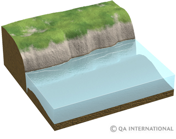
The shoreline is the coastal zone that lies between low tide and high tide. This perpetually changing landscape is subjected to the continuous action of the sea, rivers and the wind. It can assume highly varied forms, depending on the coast’s geological makeup.
They are two types of coasts. A rocky coast is eroded by waves, which hit its cliffs with considerable force (3 metric tons per cubic meter, and up to 50 metric tons per cubic meter during storms). Rock broken off from the coast in this manner is gradually reduced to finer particles, which are deposited on coasts and mix with fluvial sediment to form another type of shoreline.
From cliff to reef
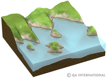
Some parts of the coast are eroded more quickly than others, depending on the type of rock that makes them up. For instance. Cliffs jutting into the sea form capes. The water carves out these exposed areas, transforming fissures into sea caves. When two sea caves meet on either side of a cape, they form a sea arch. As they are crushed, they leave a needle-shaped landmass that is subsequently transformed into an islet or reef. There where the bedrock is softer, the shoreline features a hollow, called a bay.
Beaches and marshes
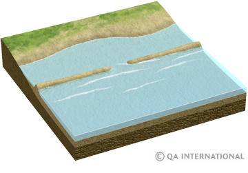
The sand and pebbles produced by the erosion of the rock face accumulate along the coast, forming a beach. A sand spit can close off a bay, forming a lagoon; when it links an island to a coast, it is called a trombolo.
At the mouths of rivers there may be partially flooded lowlands, called marshes.
Longshore drift
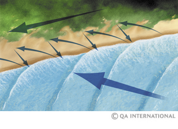
The grains of sand and pebbles deposited on the coast do not settle there permanently; they are agitated by the waves, which push them onto the shore obliquely, and then sweep them perpendicularly in the ebb, before drawing them back to shore again at an angle. This zigzag shift, called longshore drift, sets a pattern in which the sediment is moved in a precise direction.
The different types of coast
- A barrier reef (or barrier island) is a sandbar that stretches parallel to the coast, at a distance of a few kilometers to a few dozen kilometers. A lagoon forms behind this reef.
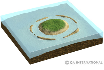
- Some shorelines are the result of volcanic eruptions. The coral reef or atoll that forms around a volcanic island presents a ring shape that encircles a lagoon.
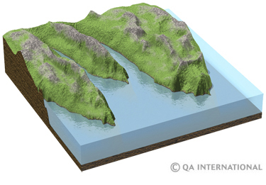
- Fjords (a word that means “long arms of the sea” in Norwegian) are valleys that were carved out by glaciers long ago and then flooded by water. They are found in abundance along the Norwegian coast.
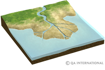
- Deltas form at the mouths of rivers. They result from the accumulation and deposit of sediment transported by rivers flowing to the sea.
- Fluvial valleys that are submerged following a rise in sea level or sinking land, forming a group of inlets cut into the coastline, are called rias.
- Geological events have sometimes modified the coast, producing rifts. Such is the case of very high shore cliffs that have been carved by tectonic rifts.